 Catalina Island Snorkeling
Catalina Island Dominican Republic Map
Last reviewed September 2026
Most search results for a Catalina Island Dominican Republic map return a single pin dropped somewhere off La Romana. This one plots the island against the two mainland ports the boats actually use, sets out the protected-area boundary that governs everything anchored inside it, and tables the snorkel sites and beaches that the coordinates cannot responsibly pin. Read it alongside the excursions that reach these waters before choosing a departure point.
Quick answer One island, two ports, and a 300-metre ring the whole layout sits inside
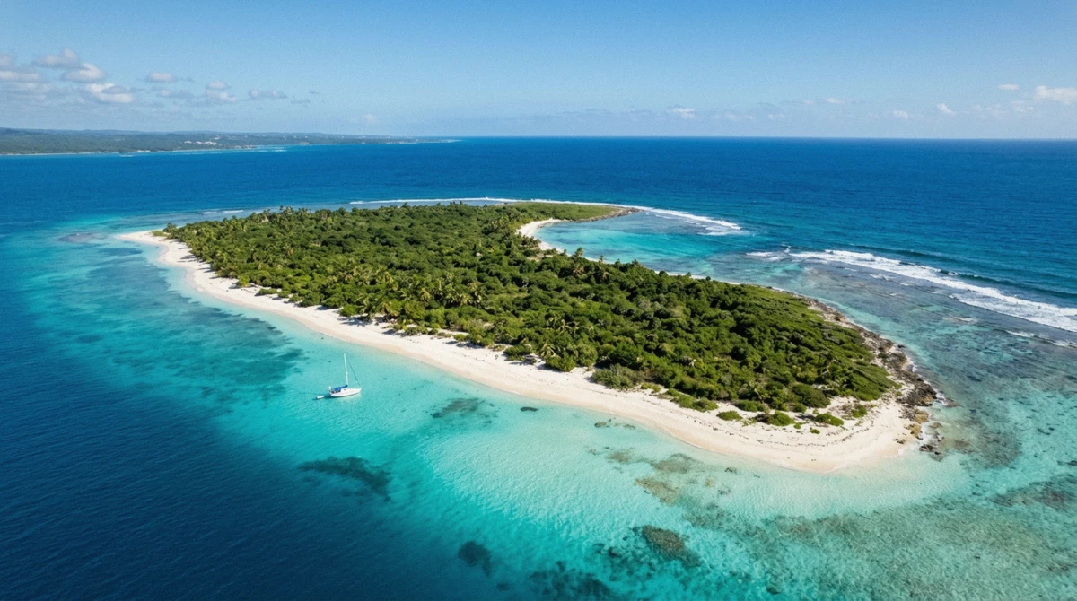
Isla Catalina sits at roughly 18.36, -69.0047, about 2.4 km off the mainland between La Romana and La Altagracia. The island itself covers 9.6 km2, but the map that governs it is bigger: the Monumento Natural Isla Catalina reaches 16.23 km2 once the surrounding water and a 300 m buffer zone are included, declared under Ley 202-04. Boats leave from Bayahibe or the La Romana cruise port, both plotted below, and neither snorkel site gets a pin here for the reason explained under the two snorkel sites.
Key takeaways
- The protected boundary runs 300 m past the island itself under Ley 202-04
- Two mainland ports feed the island, Bayahibe and La Romana, and the boats that make the crossing differ by which one they leave from
- The Wall and The Aquarium have no agreed compass side; the table under the two snorkel sites orders them by depth instead
- An airstrip crosses the middle of the island and nothing else is built on it; see what is not on the island
- Compare the listed excursions against this layout before picking a departure point, starting with the small-group tour
What the Map Shows
A layout built from one chart, not a search-result pin
The pins below come from the Ministry of Environment's own chart of the Monumento Natural Isla Catalina, edition December 2010, cross-checked against the island's Wikipedia geography and the operator listings compared on this site. That chart is also the source for the protected-area boundary, and it is the reason two features that most guides place with confidence, the compass side of The Wall and The Aquarium, are deliberately left off this map. The sources that describe those two sites contradict each other on which shore each one sits, and a wrong bearing printed with false confidence is worse than an honest gap.
Three points, not a dozen
The map plots the island's centre and the two mainland ports the excursions leave from: Bayahibe village and marina, and the La Romana cruise port. That is a deliberately short list. The snorkel sites and the island's three beaches are real places with real depths and a real visiting order, and they are set out in the tables under the two snorkel sites and the beaches rather than dropped onto the map as guessed coordinates.
A small island with an uneven interior
The land itself is not a flat sandbar. Wikipedia's geography describes coral limestone rising in three overlapping plateaus, cut through with sand dunes, a stand of mangrove and the reef that draws the boats in the first place. None of that terrain is visible on a single pin dropped in the middle of the sea; it only becomes legible once the protected boundary and the named stops under the two snorkel sites are laid on top of it.
A day-trip island this small rewards a map that shows what it is rather than just where it is.
Isla Catalina and Its Two Mainland Ports
The island centre, plotted against the two ports the crossing starts from. Coordinates are read off the Ministry of Environment's chart and the port locations used by the operator listings compared on this site, checked September 2026.
The Protected Boundary, and What It Covers
The figures below are read off the Ministry of Environment's own map sheet for the Monumento Natural Isla Catalina, edition December 2010: the legal boundary is larger than the island most visitors picture.
A natural monument with its own decree
Isla Catalina is its own protected area, declared Monumento Natural Isla Catalina under Ley 202-04, Decreto 571. The Ministry's chart puts the total protected area, island plus surrounding water, at 16.23 km2, with a 300 m buffer zone running around the outer boundary. Several tour listings, and the Ministry of Tourism's own site, describe the island as "a protected islet inside Cotubanamá National Park"; the Environment Ministry's cartography gives it a separate decree instead, so the accurate description is its own natural monument, managed as part of the same eastern protected-area complex as Cotubanamá.
The island itself, inside that boundary, is 9.6 km2 (3.7 sq mi) of coral limestone rising in three overlapping plateaus, with a highest point of only 18 m (60 ft) above sea level.
| Measure | Figure | Source |
|---|---|---|
| Legal designation | Monumento Natural Isla Catalina, Ley 202-04 | Ministry of Environment, Dec. 2010 |
| Total protected area | 16.23 km2 (island + water) | Ministry of Environment map sheet |
| Buffer zone | 300 m around the boundary | Ministry of Environment map sheet |
| Island land area | 9.6 km2 (3.7 sq mi) | Wikipedia |
| Highest point | 18 m (60 ft) | Wikipedia |
| Distance offshore | 2.4 km (1.5 mi) | Wikipedia |
Named by Columbus, uninhabited since
Christopher Columbus named the island Santa Catalina in May 1494. Nobody has lived there since, and every excursion listed on this site treats it as a day destination rather than a place with accommodation.
Why the boundary runs past the sand
A 300 m buffer that extends the protected area beyond the visible island is not a bureaucratic formality: it is the zone that keeps large vessels from anchoring directly on the reef the excursions are built around. Cruise ships that call at the island anchor offshore and tender passengers ashore rather than docking against it (the cruise-ship calendar is covered on the homepage), which is consistent with a boundary drawn to keep the water immediately around the coastline clear of permanent structures and heavy anchors. The 16.23 km2 figure is the number that actually governs what happens in the water, even though the 9.6 km2 of dry land is the number most visitors picture when they hear "Catalina Island."
The Two Snorkel Sites
Sources disagree on which shore The Wall and The Aquarium sit on, so this table orders them the way a boat actually reaches them: by depth and by the sequence most trips follow, never by compass bearing.
Ordered by depth, not by direction
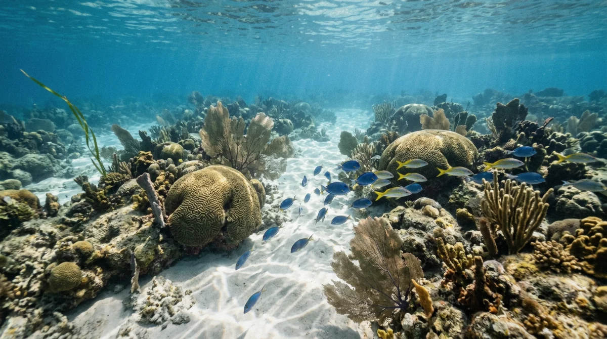
The Wall, also called La Pared, is the deep stop: the Dominican tourism board calls it "the over 100 ft Catalina Wall," while the boats themselves moor on a shallower shoulder that operator listing t406019 puts at about 30 ft (roughly 9 m), matching the soundings on the Ministry's own chart. The Aquarium, El Acuario, is the shallow stop, around 4 m (13 ft), over sand between coral heads, and the one where a first-time snorkeller usually relaxes. Natural sandbars offshore bring the depth down to a few feet in places, which is part of why the shallow site suits beginners so reliably.
Boats typically visit The Wall first and The Aquarium second, though the order varies by operator: the small-group tour and the Quetzal catamaran are the two listings that publish depths and timing for both stops; the rest treat the reef as a single unnamed stop.
One listing adds a third stop beyond the two named reefs: a shallow natural pool, visited for about 45 minutes after the main snorkel stops. That pool is not one of the two named dive sites and does not appear on any published chart under its own coordinates, so it is described here rather than pinned, a pattern that repeats through most of this page. A third shallow site on this same stretch of coast, a pirate's shipwreck in 3 m of water, gets the same treatment on its own page rather than a pin here, since no listed excursion visits it. The honest answer to "where exactly" is often a depth and a sequence, not a set of digits.
| Site | Approx. depth | Typical order | Who names a figure |
|---|---|---|---|
| The Wall / La Pared | ~9 m shoulder, falls past 100 ft | First stop on most trips | Operator t406019; Ministry of Tourism |
| The Aquarium / El Acuario | ~4 m (13 ft) | Second stop, or the beginner site | Operator t406019; Ministry map |
The Beaches
Three beaches, one of them doing all the work
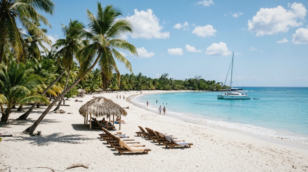
The island has three beaches (West, North and East), and the western one carries essentially all of the tourism. The excursion beach the dive boats use for their lunch stop is Playa Grande, on that western shore. None of the five listed snorkeling trips names a beach beyond the general drop-off point, so "the beach" on any given day means Playa Grande unless an operator states otherwise.
The uneven attention the three beaches get is a direct result of geography rather than marketing: the western shore faces the mainland and the sheltered crossing, while the north and east beaches face open water and the swell that the crossing itself avoids. A boat built around a short, comfortable ride from Bayahibe or La Romana has little reason to round the island to reach a beach that adds time and chop to the return leg, so West stays the working beach and the other two stay largely unvisited by the day-trip fleet.
The Mainland Ports
Bayahibe and La Romana, not interchangeable
Bayahibe is a working village, marina and dive port that sits minutes from La Romana and under an hour from Santo Domingo or Punta Cana. The La Romana cruise port is a separate departure point a short distance up the coast, used by the faster speedboat crossings rather than the catamarans. Crossing times, which boat leaves from which port, and the 80-minute road transfer that Punta Cana travelers add on top are covered in full on how to get to Catalina Island. This page only fixes the two ports on the map so the geography is clear before that page gets into schedules.
Why two ports at all, rather than one shared dock: the boats calling at each are built for different jobs. A marina port that also serves the local dive industry, like Bayahibe, favours smaller craft that can load divers and their gear quickly. A cruise port built for ocean-going ships has the depth and the space for a faster speedboat to launch alongside the same infrastructure that already handles far larger vessels. Neither layout is wrong; they simply grew around different traffic, and a listing's departure point tells you which kind of traffic it was designed to fit into.
What Is Not on the Island
An airstrip, and otherwise nothing
The Ministry's chart draws an Aerodromo (the Aerodromo de Catalina Island) across the middle of the island's flat interior. Beyond that airstrip, Isla Catalina carries no hotels, no permanent restaurants and no roads connecting the beaches to each other; every visitor arrives and leaves by boat on the same day. That is also why the fare on every listed excursion includes the protected-area admission and a packed lunch, and why none of the five trips compared on this site offers an overnight option.
What does show up on the sand, day after day, is temporary rather than built: beach vendors selling coconuts and souvenirs set up and pack down with the boats, rather than operating out of any permanent structure. One operator's own listing tells its passengers plainly to bring cash for exactly this reason. It is a useful marker of how the island actually functions: a protected natural monument that hosts a full day's commerce and then reverts to empty beach and mangrove by evening, with nobody left behind but the airstrip and the reef.
Catalina Island Map: Questions Travelers Ask
Where is Catalina Island in the Dominican Republic?
About 2.4 km (1.5 mi) off the south-east mainland, between the provinces of La Romana and La Altagracia, roughly at 18.36, -69.0047. Boats reach it from Bayahibe or the La Romana cruise port, both plotted on the map above.
How big is Catalina Island?
The island itself is 9.6 km2 (3.7 sq mi) of coral limestone, rising to a high point of just 18 m (60 ft). The legally protected area around it, water included, is larger: 16.23 km2 under Ley 202-04, with a 300 m buffer zone at the edge.
Is there anything built on Catalina Island?
An airstrip, the Aerodromo de Catalina Island, crosses the flat interior on the Ministry's own chart. There are no hotels, restaurants or roads between beaches; every excursion is a day trip, arriving and leaving by boat.
What is the protected area around Catalina Island?
The Monumento Natural Isla Catalina, declared under Ley 202-04, Decreto 571. It covers 16.23 km2 of island and surrounding water, with a 300 m buffer zone around the outer boundary. Several listings call the island part of Cotubanamá National Park; the Environment Ministry's own map gives it a separate decree, managed alongside that same protected-area complex.
Which beach do the excursions use?
Playa Grande, on the island's western shore, the same shore that carries essentially all of the island's tourism across its three beaches (West, North and East).
Why doesn't this map show exactly where The Wall and The Aquarium sit?
Because the sources disagree on which shore each one is on: one dive guide puts The Wall east and The Aquarium west, while the island's own beach guide describes the geography differently. Rather than guess a bearing, this page orders the two sites by depth and by the sequence most boats visit them, in the table above.
A map of Isla Catalina is really two maps stacked on top of each other: the small, uninhabited landmass with its airstrip and three beaches, and the much larger legal boundary that governs where a boat can anchor and what a diver can take home. Knowing both before you book changes what you ask a listing about, not just which beach it lands on, but whether the crossing leaves from Bayahibe or La Romana, and how far that departure point sits from where you are staying. The listed trips print their own departure points and crossing times against this same layout, and the full Catalina Island snorkeling breakdown lays every one of them side by side.